


Voting Member Vacancy
The Region 10 Lower Colorado-Lavaca Regional Flood Planning Group (RFPG) is soliciting nominations to fill a voting position representing Environmental Interests for a term to expire on July 10, 2028.
Environmental interests are defined as those persons or groups advocating for the protection or conservation of the state's natural resources, including but not limited to soil, water, air and living resources.
Region 10 is comprised of 43 counties including the entirety of Colorado, Jackson, Kimble, Llano, Mason, Matagorda, McCulloch, San Saba and Wharton, and portions of Austin, Bastrop, Blanco, Brazoria, Brown, Burnet, Caldwell, Calhoun, Callahan, Coleman, Comanche, Concho, DeWitt, Eastland, Edwards, Fayette, Fort Bend, Gillespie, Gonzales, Hays, Kendall, Kerr, Lampasas, Lavaca, Lee, Menard, Mills, Real, Runnels, Schleicher, Sutton, Taylor, Travis and Victoria.
To be eligible for voting membership in the Region 10 Lower Colorado-Lavaca RFPG, a person must be capable of adequately representing the interest for which a member is sought, be willing to participate in the regional flood planning process, attend meetings, and abide by the RFPG bylaws. The bylaws are available online at www.lowercoloradolavacaflood.org/members.
Additional information regarding the flood planning process is available online at www.lowercoloradolavacaflood.org and www.twdb.texas.gov/flood/planning.
To submit a nomination, please complete the nomination form online at www.lowercoloradolavacaflood.org. Nomination forms must be received by 5 p.m. on Thursday, Aug. 20, 2026.
Email questions to lowercoloradolavacaflood@lcra.org.
Subscribe to Notifications
Receive notifications for upcoming Region 10 announcements and events
Upcoming Meeting Information
-
RFPG10 Regional Planning Group Hybrid Meeting - September 17, 2026 - 9:30AM
RFPG10 Regional Planning Group Hybrid Meeting - December 10, 2026 - 9:30AM

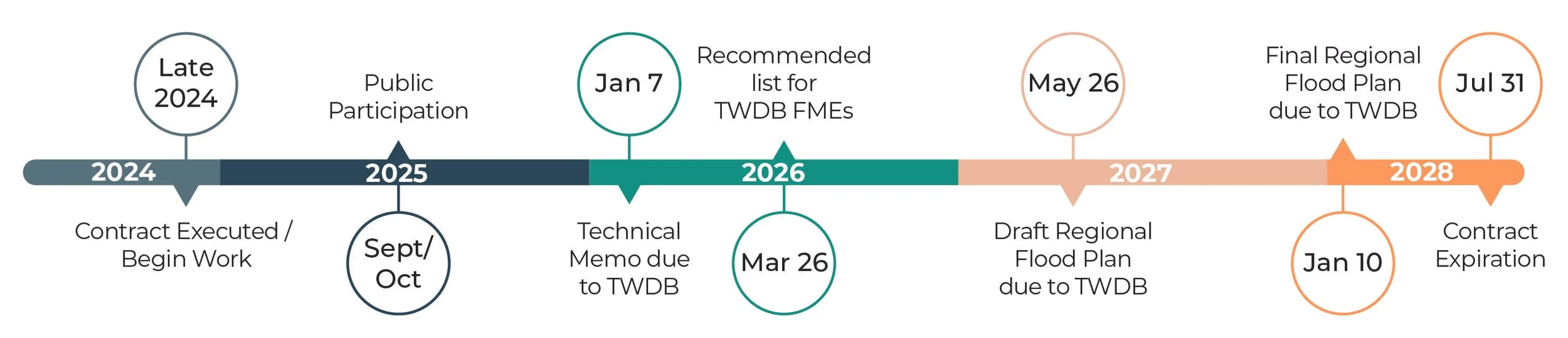
Cycle 2 of the Regional Flood Planning for Region 10 is now underway through 2027.
The first Texas Flood Plan is being developed by TWDB staff from the 15 regional flood plans and is set to be adopted by the TWDB in September 2024.
IMPORTANT. If your community is in need of a flood management study or flood mitigation project AND you plan to seek funding support from the TWDB, your study or project MUST be included in the regional flood plan—and ultimately the State Flood Plan. Your project’s inclusion in the Plan may also help with financial assistance from other state or federal agencies.
Regional Flood Planning is an ongoing process and is designed to produce an updated State Flood Plan every five years.
CLICK TO REVIEW THE WORKPLAN OF THE LOWER COLORADO-LAVACA REGIONAL FLOOD PLANNING GROUP
Regional flood planning, as authorized by the Texas Legislature
and implemented by the Texas Water Development Board,
is designed to safeguard Texas communities.
In 2019, the Texas Legislature passed Senate Bill 8 directing the creation of the first-ever State Flood Plan for Texas—to be prepared by the Texas Water Development Board (TWDB) and to follow a similar region-driven “bottom-up” approach that’s been used for water supply planning in Texas for the past 20 years. Flood planning cycles will be every five years.
Fifteen flood planning regions have been established — based on river basins. Community and public stakeholder involvement is encouraged. The overarching goal of regional flood planning, and the comprehensive state flood plan that will result from the plans created by these regions, is to protect against loss of life and property from flooding.
Click to view the work plan for Amendment of the Initial Regional Flood Plan (March 6, 2023).

Region 10 Flood Planning Region
includes the Lower Colorado
and Lavaca River Basins.
43 counties wholly or partially
included in Lower Colorado-Lavaca
Flood Planning Region
(click to enlarge map)
Facts about Region 10
43 counties
43 counties, or a portion of each, are included in this basin
~10% w/in 1%
Ten percent of the region is within the FEMA 1% annual chance flood event (100 yr. flood)
24,380 sq. miles
Total area of the region
1,877,786
Population 2019
2,866,025
Population 2050, projected ~ 50% increase
2 river basins
Two major river basins: the lower portion of the Colorado River and the Lavaca River basin
Tributaries
Major tributaries: Llano, Pedernales, San Saba, Lavaca & Navidad rivers, Sandy, Onion, Cummins and Champion creeks
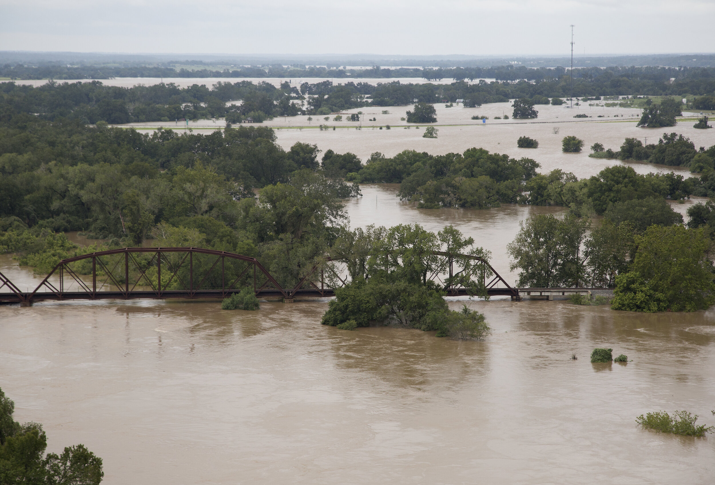
110 flood events
110 major flood events have occurred in last 20 year with significant losses to life and property
Flood disasters
Between 1953-2020: 50 major disaster declarations and 6 emergency declarations
Each region has a Regional Flood Planning Group (RFPG)
Every RFPG is comprised of at least one representative from each of 11 interest categories specified in the legislation.
Public
Counties
Municipalities
Industries
Agriculture
Environment
Small Business
Electric Generating Utilities
River Authorities
Water Districts
Water Utilities
Each RFPG is responsible for developing a regional flood plan in accordance with Texas Water Development Board (TWDB) requirements. Flood mitigation projects must be included in a regional flood plan to qualify for TWDB funding. TWDB will combine the regional flood plans into a single State Flood Plan to be delivered to the TWDB in January 2023.
Regional Flood Planning Group responsibilities
Select contract administrator to handle contracts and billings (LCRA is Administrator for Region 10)
Hire consultants to assist with technical details of plans (Halff & Associates is the technical team lead, with support from Freese and Nichols, HDR, WaterPR)
Obtain local input on existing and needed flood plans, studies, goals, strategies and flood mitigation projects
Develop the Initial Flood Plan by 2023
Hold public meetings and receive public comments
Update plan every five years
Included in Regional Flood Plans
Flood Hazard Risk Assessment
Flood Management Evaluations (FME)
Flood Management Strategies (FMS)
Flood Management Projects (FMP)
No adverse impacts
Potential for contributions to water supply
Cost Estimates
Project Prioritization
Administrative, regulatory and legislative recommendations
Data collected by RFPG and Technical Team
Available historical floods (dates, rainfall amounts, damages, flood claim totals, etc.)
Flood studies
Land use plans
Local flood issues (hot spots, urban flooding, flooded roads, etc.)
Local flood mitigation infrastructure and projects
General info on flood disaster preparations, flood models, infrastructure, critical facilities, flood response plans, etc.